Severe thunderstorms are expected across the Southeast, particularly in Mississippi and northwestern Alabama. However, these storms will quickly diminish due to the lack of instability and buoyancy. While there is a possibility of isolated hail, damaging straight-line winds, and maybe even an isolated tornado due to the veering with height, the limited buoyancy prevents a significant threat. These storms are likely to impact the region throughout the morning and into the afternoon before gradually moving eastward and weakening. For more information on the forecast, please refer to the details below.
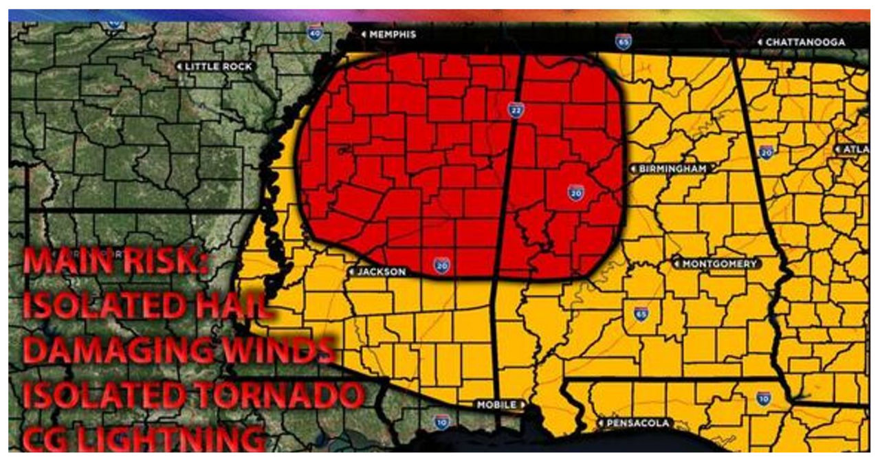
Main impact: isolated large hail, damaging winds, isolated tornadoes possible.
Approximate Timing: Expected to form around the morning hours through afternoon before the cold front pushes through quickly from west to east.
Overall Forecast: Ongoing storms will persist from AR into neighboring states, but the main threat will be damaging winds due to the limited instability. On Friday morning, a strong, enhanced shortwave trough will move into the central Plains, accompanied by a very intense jet stream with winds exceeding 120 knots in the mid/upper levels of the atmosphere. This system is expected to rapidly move northeastward through the Mid-South and affected regions. Meanwhile, a surface low will be located around MO, and a fast-moving cold front will sweep through the southeast, passing through a saturated airmass with limited instability and buoyancy. Strong vertical shear will be present, particularly across MS and the entire southeast, providing sufficient effective shear. However, due to the lack of instability and buoyancy, storms may struggle to organize effectively, reducing the potential for severe weather to some extent. If storms maintain a discrete nature, they may have the chance to produce isolated tornadoes given the strong shear values. Regardless, any storms that do develop will carry the risk of generating powerful straight-line winds and possibly an embedded isolated tornado. The expectation is for storms to become more linear and merge before the front moves through, stabilizing the atmosphere.
Mainly from northern Mississippi through Alabama and Georgia, storms are anticipated on Friday. These storms pose a potential risk of damaging straight-line winds. Initially, they are expected to affect Arkansas and Louisiana in the morning. Subsequently, more storms are likely to develop ahead of a rapidly advancing cold front in northern Mississippi and move eastward. However, their intensity is expected to diminish as they traverse Alabama and the rest of the southeastern region. By the afternoon, the cold front is projected to swiftly move through the area, ultimately progressing eastward by Friday night.